This Bulgarian bio-region covers the territory of the Sredna Gora Mountains, with total area of 5990 km², a length of 285 km, and a width of 50 km. The population of the region is 121 440.
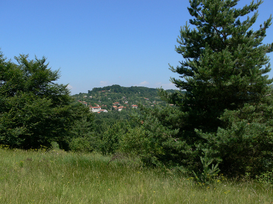
The Sredna Gora Mountains are situated in the central part of Bulgaria between the Balkan Range and the Thracian Plain. The highest peak is Mt. Bogdan, at 1604 m. It is parallel to the Balkan Mountains. The Sredna Gora Range is divided into three parts by the rivers Topolnica and Stryama: the Western (so-called Ihtimanska), where the Municipality of Ihtiman is located; the Middle (so-called Real), with the Municipalities of Panagurishte, Strelcha I Karlovo; and the Eastern (Sarnena), with the Municipality of Brezovo.
The climate is mid-continental. Winter temperatures are between -1 and +1 С.; summer temperatures in the lower area are about 20 С, and about 16 С in higher parts. Snow cover remains 1-2 months. With its forests of oak and beech and numerous caves and hot springs, the region was inhabited by humans as early as the 5th Millennium BC. The Thracians left a hoard of gold treasure at Panagurishte, and the Romans a crop of ruins at Hissarya. The pilot Bulgarian bioregion “Sredna gora” consists of six municipalities with the following characteristics:|
Municipalities |
Municipal. center |
Inhabitants |
Territory ha |
Forest territory ha % |
Agriculture territory ha |
|
Panagurishte |
21 000 |
30 240 |
59 800 |
28 000 46.7 % |
24 200 (40.4 %) |
|
Strelcha |
4 900 |
5 800 |
22 400 |
8 500 38 % |
12 900 57 % |
|
Hissar |
8 900 |
15 200 |
54 900 |
25 000 37 % |
33 000 40% |
|
Brezovo |
1 900 |
8 000 |
46 500 |
21 000/ 45 % |
23 200 49 % |
|
Karlovo |
29 000 |
62 200 |
1 09 000 |
51 200 47 % |
45 700 44 % |
|
Ihtiman |
13 700 |
19 500 |
51 600 |
26 500 51% |
19 500 38% |
|
Total |
79 400 |
140 940 |
3 44 200 |
153 400 44% |
158 500 46 % |
The region is environmentally clean, with well developed agro and forest activities. It is not rich in ores and minerals and far from natural gas distribution pipelines. Electricity, oil for the industrial sector and coal and wood for heating in residential sector are the main fuels used. The region is rich in biomass waste, which is not used efficiently. Only in one municipality, Ihtiman, has a biomass 3 MW heating plant based on chips been established. Two PV plants (about 2 MW) were established recently.
The forest management is carried out by five forest administrations that cover five territories with the following characteristics:
|
LMA -Local management administration |
Total territory ha |
Industrial territory ha |
Wood stock m³х1000 |
Annual growth m³/ha |
Annual use m³ |
|
LMA (Strelcha and Panagurishte) |
41 600 |
36 100 |
4 040 |
2.70 |
40 000 |
|
LMA (Hissar) |
20 800 |
7 500 |
1 117 |
2.87 |
17 700 |
|
LMA(“Chekeritsa” Brezovo) |
22 286 |
14 400 |
3 414 |
2.56 |
43 500 |
|
LMA (Karlovo) |
25 614 |
20 790 |
2 957 |
3.04 |
40 500 |
|
LMA (Ihtiman) |
26 500 |
23 900 |
3 871 |
3.0 |
48 000 |
|
Total |
136 800 |
102 690 |
15 399 |
- |
189 700 |
The state owns 79% of the territory of the region, followed by municipal property, 13%. The share of private property is negligible.
Theoretical Energy Potential in the Region
|
Afforested area |
Wood mass |
Annual growth |
Average growth per 1 hа |
Energy potential 50% |
Energy potential |
Energy equivalent 50% humidity |
|
ha |
thousands of m3 |
m3 |
m3 |
m3 |
t |
MWh |
|
102 690 |
11 528 |
290 666 |
2.85 |
146 333 |
117 000 |
292 500 |
Technical energy biomass potential (based on logging)
|
LMA--Local management administration |
brushwood m3 |
branches m3 |
Wood for heating m3 |
Total wood m3 |
|
LMA (Strelcha and Panagurishte) |
800 |
3 299 |
21 076 |
25 175 |
|
LMA (Hissarya) |
239 |
2 188 |
6 298 |
8 725 |
|
LMA(“Chekeritsa” Brezovo) |
246 |
4 530 |
14 740 |
19 516 |
|
LMA (Karlovo) |
450 |
6500 |
21 602 |
28 552 |
|
LMA (Ihtiman) |
530 |
7 800 |
25 500 |
33 830 |
|
Total |
2 265 |
24 317 |
89 216 |
115 798 |
Total biomass is assessed at 115 798 m3 , or 92 638 tons, with an energy equivalent of 230 GWh (78% of the theoretical potential).

BioRegions is supported by the EC under the programme Intelligent Energy Europe
© 2020 www.bioregions.eu
Web site design and development by www.qv-web.eu
The sole responsibility for the content of this webpage lies with the authors. It does not necessarily reflect the opinion of the European Union. Neither the EACI nor the European Commission are responsible for any use that may be made of the information contained therein.